
Vinegia (Venice), Apresso i Giunti, 1565. - Colophon: In Veneta, Nella Stamperia di Domenico Nicolini;...de gli heredi di Luc'antonio Giunt, 1565.
Folio. (30 x 21 cm.). Bound later (around 1800) in hcalf. Spine divided in 6 compartments, all richly blindtooled and in the middle of each a small gilt rosette. A crack to joint (2 cm.) at upper compartment. Light wear along edges. Marbled endpapers. Red edges. (22),286 leaves. With engraved map (a reproduction in smaller size of "Carta Marina") - the map in FACSIMILE, and more than 450 fine woodcut illustrations in the text, the the greatest part measuring 59 x 93 mm, a few half-page and some 1/3-page. Woodcut device on title-page and on colophon-leaf. Title-page mounted and with small closed tears. Title-page slightly soiled. A faint dampstain to upper corners on Index-leaves ("Tavola"), which appears again in more weakened form towards end. A faint dampspot in upper inner margin throughout. The last few leaves with a bit of browning, 2 small holes in last leaf with loss of a few letters.
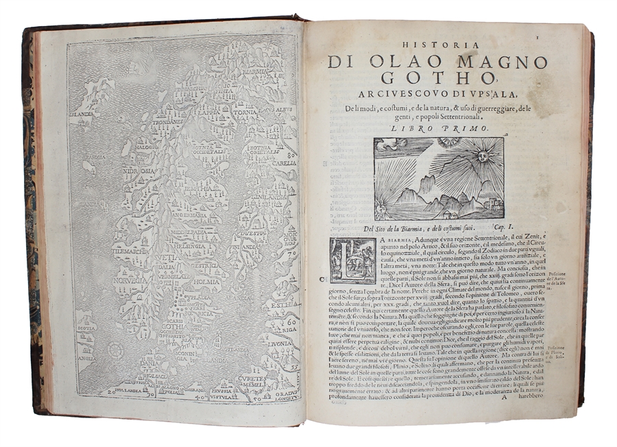
First Italian folio edition (and in full), being the second folio-edition as well as the second edition in the vernacular, of Magnus' great work "Historia de gentibus septentrionalibus", 1555, which constitutes one of the most important sources on the Northern customs and daily life of the time.
The present first Italian edition published 10 years after the first edition, which is in Latin, Rome 1555. A French translation appeared, in 8vo, in 1560-61).
In reality, this famous work is a large commentary and notes to Olaus Magnus' own map, the famous "Carta Marina", which he published in Venice in 1539, of which only two copies are known. The Carta Marina ("Map of the Sea" or "Sea Map"), is the earliest map of the Nordic countries that gives details and place names. Only two earlier maps of Scandinavia are known, those of Jacob Ziegler and Claudius Clavus. The "Carta Marina" is reproduced here in smaller size, but in facsimile.
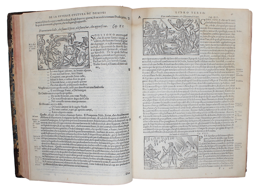
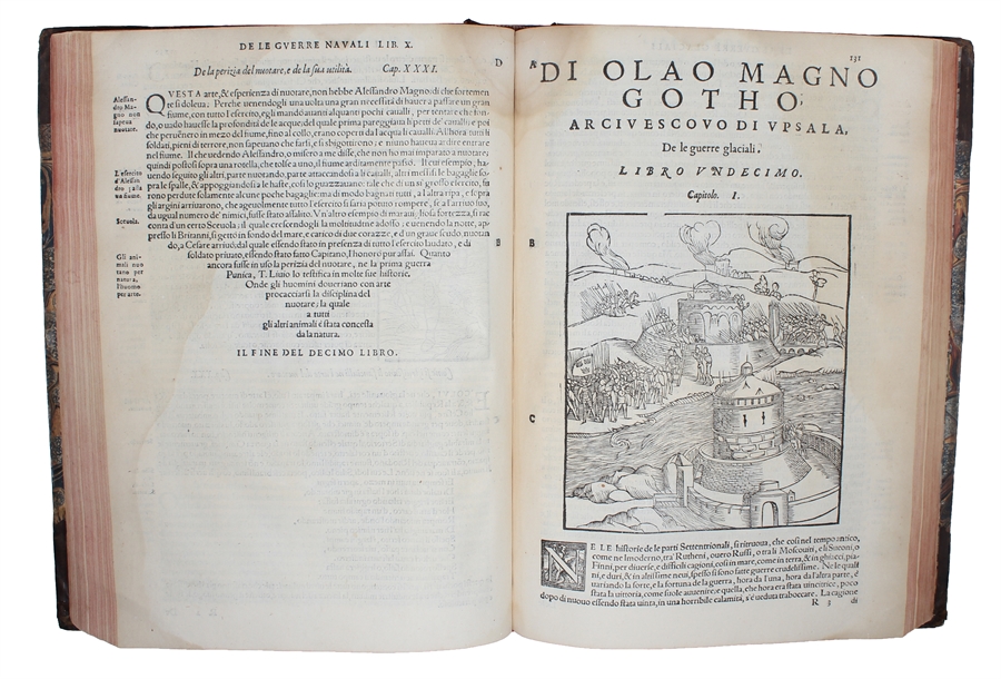
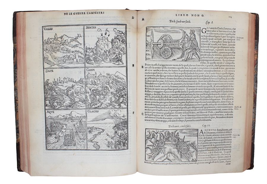
The woodcut illustrations and views - here printed with the same woodblocks as the Rome edition of 1555 - are of the greatest importance to the cultural history of the Nordic countries, as they illustrate the religions, folklore, occupations, as well as the geographies, fauna etc. of the Scandinavian people. They have since been reproduced a number of times. The artist is not known, but they are probably carved after sketches by Olaus Magnus himself.
Swedish Books 1280-1967, No. 18. - Collijn "Sveriges Bibliografi intill År 1600", II: p. 221.
Order-nr.: 55037