
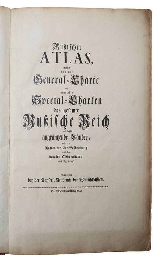
St. Petersburg, Entworffen bey der Kayserl. Academie der Wissenschaften, 1745.
Folio (527 x 327 mm). In contemporary full calf, boards panelled in blind with double ruled fillets forming a broad central rectangle. Rebacked and boards with some soiling and scratches. Pasted down front end-paper with two ex-libris (Samuel Thornton and Victor Procope, see below). Text with light marginal browning and map no. 19 with small repair to the verso at the lower right corner. Large folding map reinforced on the verso along margins and folds. An overall very nice and well preserved handcoloured copy copy. [blank], (8) pp. + 19 double-page maps and one large folding general map, all handcoloured.
Housed in a nice clam shell box with leather title-label to front board and Victor Procope's name in gilt at the foot. Interior lined with velvet.
Provenance:
Samuel Thornton (1754-1838): John Thornton was the biggest English merchant trading to Russia, held the contract for Government remittances to Russia during the seven years’ war, and was a large contributor to Government loans. Director, Bank of England 1780-1836 and Member of Parliament for Kingston upon Hull (with William Wilberforce in 1784) from 1784 to 1806 and for Surrey from 1807 to 1812.
Johan Victor Procopé (1918-1998): Finnish economist, member of the Parliament of Finland and renowned book collector.
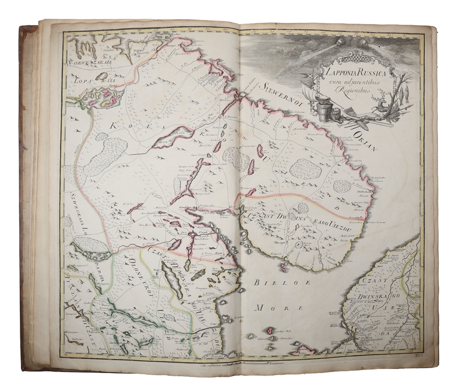
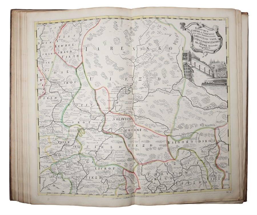
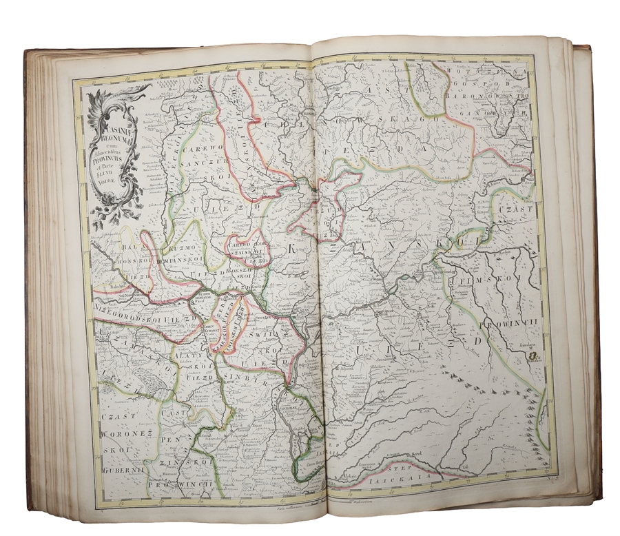
First edition, handcoloured and with an interesting provenance, of the first printed atlas of Russia, one of the great cartographic monuments of the eighteenth century and a cornerstone in the scientific mapping of the Russian Empire. 'As the most complete representation of Russia to date, the atlas gave the European public a knowledge of the vastness and complexity of the Russian Empire' (Whittaker). “From 1719, all Russian cartography came under the first Russian director of the Cartographic Office, Ivan Kirilov. At his urgent representation, Joseph Nicolas Delisle, brother of the famous French astronomer and cartographer Guillaume Delisle, was invited to Russia. Kirilov and Delisle held diametrically opposed views on the expeditious construction of maps: Delisle was of the opinion that no surveying should be undertaken until a detailed network of astronomically determined points had been established, while Kirilov held that surveying could proceed from river and other geographical features as points of reference, with the survey subsequently adjusted to the astronomically determined points. Kirilov realised that Delisle’s methods could never produce a map of Russia in a short space of time, and decided to make a start on an atlas of Russia on his own account and using his own methods, but relying on Delisle for expert advice. Bering’s first voyage had not been very successful, and in 1732, four years after his return, it was decided to equip a second expedition, known as “the Great Northern Expedition”. It was to consist of several parties working simultaneously from Yugorski Shar in the west along the coast of the Arctic Ocean as far as Sakhalin in the east; and this titanic labour was completed in ten years. At this time, the Academy of Sciences wanted to get the atlas published, but Delisle, who kept putting forward new production methods and principles, was unwilling to allow the maps to be given their final form. Accordingly, while Delisle was away making astronomical observations, Schumacker, one of the directors of the Academy, took advantage of his absence and rushed the atlas off the stocks. It was completed in 1745. Delisle agreed to submit the completed atlas to the Academy, and thus gave his name to it, though by rights it should not bear his name. It consisted of a general map and 19 maps of smaller parts of the country, covering the whole of Russia. Delisle’s contemporaries thought very highly of it, and the famous German scholar Euler held it up as a model to a Germany as yet without a complete atlas of her own.” (Bagrow, History of Cartography, p. 175). Phillips 3109.
The text was issued simultaneously in Russian, German, Latin and French.
“Compiled under the direction of Joseph Nicolas Delisle, who was called to St. Peterburg in 1726 to take charge of the work. In 1740, in order to hasten the completion of the atlas, he was assisted by several scientists, including his brother Louis. The atlas was finished in 1745 and published in same year by the academy of sciences of St. Petersburg.” (Phillips)
Shirley T.DEL-2d (p. 471).
Order-nr.: 63099